
|
|
| DEUTSCHLAND | GERMANY |
| Bundesland: Freistaat Bayern | Bavaria |
| Regierungsbezirk: Oberbayern | |
| Landkreis: Rosenheim |
map →
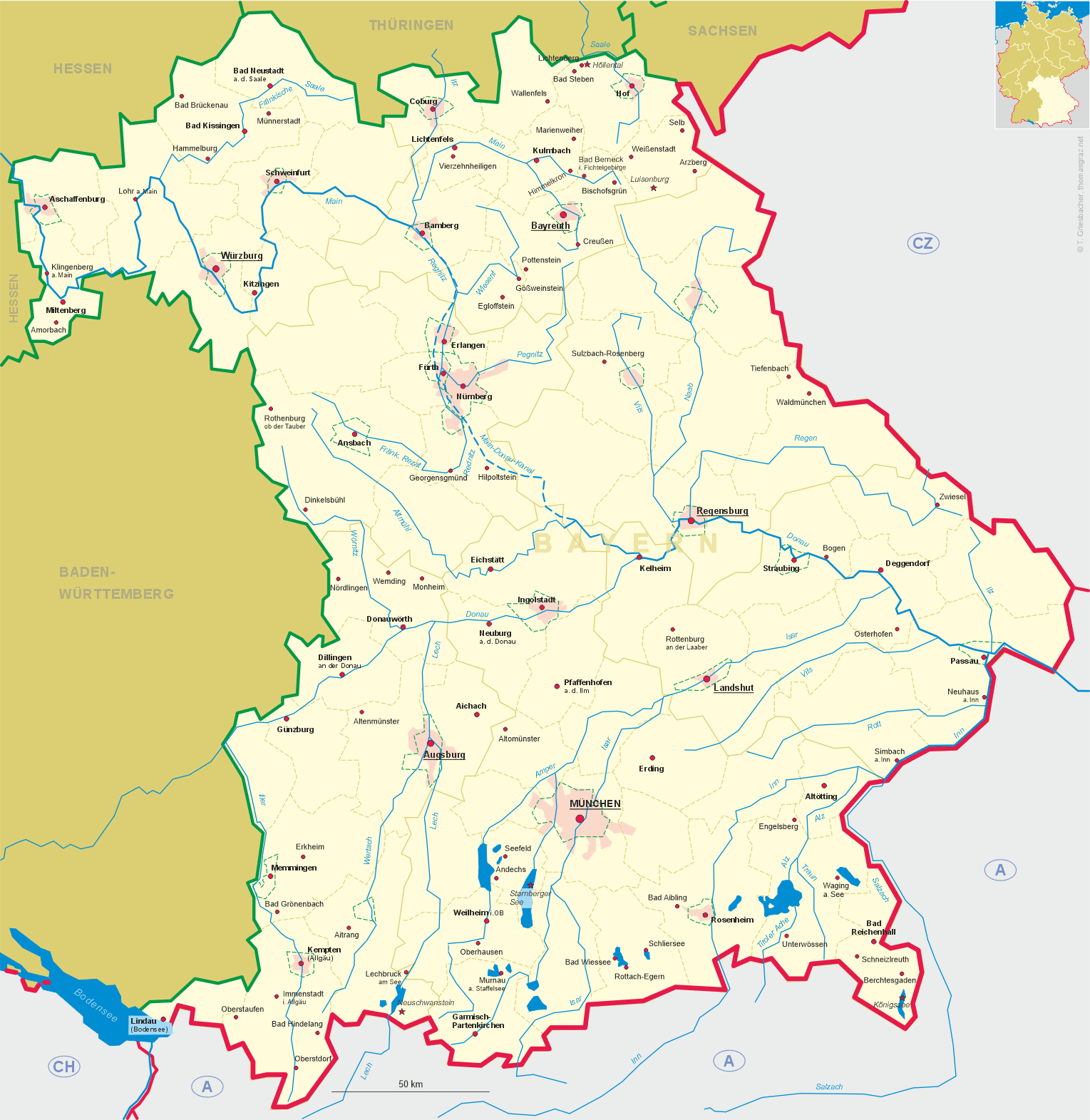
 Prien am Chiemsee (officially Prien a. Chiemsee) is situated at an elevation of 533 m at the western shore of
Chiemsee, the largest lake of Bavaria. The district town Rosenheim lies about 18 km to the west, the Bavarian
capital Munich lies about 66 km to the northwest. The municipality has a population of about 10,900 (2024).
Prien am Chiemsee (officially Prien a. Chiemsee) is situated at an elevation of 533 m at the western shore of
Chiemsee, the largest lake of Bavaria. The district town Rosenheim lies about 18 km to the west, the Bavarian
capital Munich lies about 66 km to the northwest. The municipality has a population of about 10,900 (2024).
Prien was founded in the mid-12th century (around 1158) as the administrative centre of the counts of Falkenstein. It was a parish within the diocese of Chiemsee, which was directly subordinate to the archbishops of Salzburg. As part of the administrative reforms in Bavaria in 1818, Prien am Chiemsee became an independent municipality. The opening of the Rosenheim–Salzburg railway line in 1860 and the general opening of Herrenchiemsee Palace in 1886 heralded the dawn of the tourism era. The Chiemsee boat service, whose main port is Prien, was expanded; hotels and guesthouses sprang up; and numerous city dwellers built their summer villas around the town, which was granted market town status in 1897.
The  parish church Mariä Himmelfahrt (Ascension of Our Lady) [background right, barely visible]
goes back to a first church from the late 12th century, which likely was located somewhat further west of the current location. A later,
late Gothic church of the second quarter of the 15th century was largely modified after about 1510. The church was remodelled in the
Baroque style in 1652–1659. A new, larger church, again in the Baroque style, was constructed in this place from 1734 onward.
parish church Mariä Himmelfahrt (Ascension of Our Lady) [background right, barely visible]
goes back to a first church from the late 12th century, which likely was located somewhat further west of the current location. A later,
late Gothic church of the second quarter of the 15th century was largely modified after about 1510. The church was remodelled in the
Baroque style in 1652–1659. A new, larger church, again in the Baroque style, was constructed in this place from 1734 onward.
[https://de.wikipedia.org/wiki/Prien_am_Chiemsee;
https://de.wikipedia.org/wiki/Mari%C3%A4_Himmelfahrt_(Prien_am_Chiemsee)]
![[scale]](lineal.jpg)